Navigation
Install the app
How to install the app on iOS
Follow along with the video below to see how to install our site as a web app on your home screen.
Note: This feature may not be available in some browsers.
More options
You are using an out of date browser. It may not display this or other websites correctly.
You should upgrade or use an alternative browser.
You should upgrade or use an alternative browser.
navigation app. for android
- Thread starter KLM
- Start date
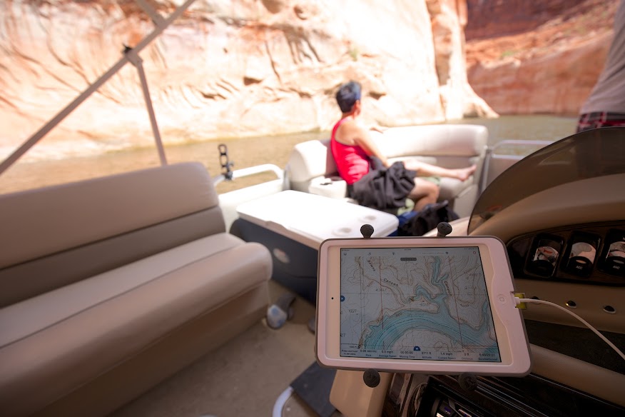
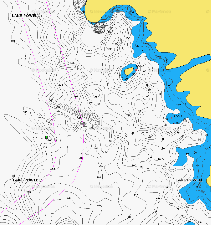
The only accurate water depth you could get would require a transducer, but Navionics comes pretty close on their maps. It's well worth the $50 cost to buy their app. I could navigate home in pitch blackness at Lake Powell using their app.
Interesting. I only ever used BC Navigator for hiking so I didn't realize it had that feature. Are their depth charts static to one water level or are they updated like on Navionics? On Lake Powell where it fluctuates wildly, it's nice to have it automatically update with fairly current conditions. Higher end chart plotters using Navionics record the underwater topography and crowdsource the data. Those people also often flag underwater rocks (whales), good fishing spots, etc.
Screenshot with the Lakes Overlay active.

One other nice feature (not sure if navionics has it or not...) is you can download the maps so that you have all the detail even when you have no signal. But warning...they are big. My phone is 16gig with no memory card slot (Nexus5) and I can easily eat up 4 or 5 gig with maps.
That I know of, they don't update automatically or crowd source data. I only use depth charts to decide if I should be watching my depth gauge or not. Hazards to navigation are indeed marked on the lakes overlay for Lake Michigan. But there are no alarms that I know of. The maps do get updated periodically, but not like a crowd sourced data base. The lakes where I boat fluctuate a little. But no tides or reservoir type fluctuations.
Last edited by a moderator:
Nice. Yes, Navionics and GPS Gaia both have that download maps feature. I'd be hosed without it. I really like to be able to download the google satellite imagery in GPS Gaia so that I can spot out beaches and potential campsites without having to check every little nook and cranny of each side canyon.
The Navionics app has a web app that lets you play with it before you buy it for your device or chart plotter. Kind of a fun thing to play with.
http://webapp.navionics.com/
Too bad the BC Navigator is still an Android-only app. I wouldn't mind adding it to my kit. You'd think by now they would have ported that to iOS.
Navionics Screenshot: